
The Hidden Trap of Buying Land Without Understanding Your Boundaries
You finally bought that perfect piece of land, but what if I told you the old wooden fence you are looking at is lying to you? It happens all the time. People spend their life savings on a property, only to find out their driveway actually belongs to the guy next door. I have seen buyers go through this expensive nightmare, so let’s make sure you never fall into that trap
Buying a piece of land is often one of the biggest investments you will ever make in your life. You save up your hard-earned money for years, dreaming of building your perfect home or starting a profitable project.
But imagine waking up one day to find your neighbor building a fence right through what you thought was your driveway. Suddenly, your peaceful dream turns into a nightmare of angry arguments, threats, and expensive court cases.
This is the sad reality for thousands of buyers who skip learning how to read a boundary plan. They trust a handshake or a seller's word instead of verifying the actual, legal lines on paper.
Many home and land buyers struggle to protect their investment because of several common traps:
- They rely on visual guesses like old fences, tree lines, or what the seller points to with their hand.
- Sellers and real estate agents often do not understand the maps themselves and might give you wrong information just to close the deal.
- Official land documents look too complicated with strange numbers, angles, and symbols, making buyers give up on reading them.
- People assume that basic title insurance will automatically fix any future boundary fight without any effort on their part.
This confusion does more than just hurt your wallet; it destroys your peace of mind and your confidence.
- You might spend sleepless nights worrying about losing a valuable portion of the land you paid for.
- The constant anxiety of a potential lawsuit with a neighbor ruins the joy of owning your property.
- Your confidence as an investor drops when you realize you made a blind purchase based on blind trust rather than hard data.
- We understand this stress and want to make sure you never have to go through this painful, draining experience.

What You Will Learn Today (Quick Summary):
- Why you should never trust old fences or tree lines as your true boundary.
- How to easily read the legend, compass, and scale on your paper map.
- The simple way to use free phone apps to track down your land corners.
- Why finding the physical iron pins in the dirt is the only way to prove you own the exact spot.
How to Master the Art of Reading Your Land Map
To protect your money and your future home, you must learn to read a property map like an expert. Do not let the lines and numbers scare you, as they are actually easy to understand once you know the basics.
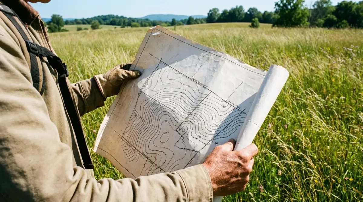
We have put together a clear, simple guide to help you read these maps with complete confidence. Let’s break down the first three steps you need to take before you sign any purchase contract.
1: Find the Secret Key of Your Land Map
Before you look at the lines, you need to find the legend box, which is usually located in one of the corners of the map. This box is the dictionary of your property map, explaining what every line, dot, and symbol means.
If you ignore this box, you might mistake an underground utility pipe line for your actual property boundary. We do not want you to make that mistake, as it can limit where you are legally allowed to build.
The legend will show you what different types of lines represent on the paper. For example, a solid line usually shows the main property boundaries, while a dashed line might show an easement.
You will also see small symbols for physical markers on the ground, such as iron pins, concrete posts, or wooden stakes. These markers are critical because they show you exactly where the corners of your land are physically located.
Imagine a buyer named John who bought a beautiful wooded plot without looking at the map legend. He assumed a dotted line on his map was a walking path he could use to build a small cabin.
Later, he learned that the dotted line was actually a high-voltage power line easement owned by the city. Because he did not check the legend, he had to change all his building plans at a high cost.
Quick Cheat Sheet: What Map Symbols Actually Mean
Here is a quick look at the most common symbols you will find on your paper map:
| Map Symbol | What It Means For You |
| :--- | :--- |
| Solid Dark Line | Your actual, legal property boundary. |
| Dashed or Dotted Line | An easement (You usually cannot build here). |
| Small Circles / Dots | Physical markers like iron pipes placed in the dirt. |
| Wiggly Lines | A natural feature, like a creek or a small stream. |
2: Understand the Compass and the Scale Bar
Once you know what the symbols mean, you need to understand how big the land is and which way it faces. To do this, you must look for two important tools on your map: the compass rose and the scale bar.
These two tools give you the sense of direction and size that you need to plan your construction safely. They prevent you from designing a house that is too big for the actual plot of land.
The compass rose is a small graphic that shows you which direction is North, South, East, and West. Most property maps are drawn with North facing toward the top of the page, but you must always double-check this.
Knowing where North is helps you understand how the sun will hit your future house throughout the day. This is incredibly helpful when you are planning where to place your windows, gardens, or solar panels.
The scale bar is a ruler printed on the map that translates paper inches into real-world feet or meters. For example, the scale might say that one inch on the paper equals fifty feet on the actual ground.
To use it, you can take a physical ruler, measure a distance on the paper, and multiply it by the scale number. This simple trick allows you to estimate the width of your yard or the distance from your house to the boundary line.
[Paper Measurement: 2 Inches] --> [Scale: 1 Inch = 50 Feet] --> [Real Distance: 100 Feet]
3: Trace the Boundaries Using Metes and Bounds
The most important part of reading your survey map is tracing the actual lines that define the shape of your land. This system of describing land is often called the "metes and bounds" method.
"Metes" refers to the measurements of distance, while "bounds" refers to the boundary limits and physical markers. Understanding how these work together will help you see the exact shape of your property in your mind.
On the boundary lines of your map, you will see numbers like "N 45° 30' E" along with a distance like "120 feet." This is a bearing, which tells you the exact angle of the boundary line relative to North or South.
While it looks like complex geometry, it simply tells you which direction the boundary line runs as it moves toward the next corner. If you follow these directions and distances step by step, you will circle the entire property and end up exactly where you started.
As you trace the lines, look closely for any lines that cross over your property boundaries from the outside. These are often signs of encroachments, which happen when a neighbor's structure sits on your land.
For example, a neighbor's shed, driveway, or garden might be crossing over your line by a few feet. Finding these issues on the map before you buy the land gives you the power to ask the seller to fix the problem.
Additionally, look out for public easements, which give utility companies or the public the right to use a portion of your land. These easements are legally binding, and you cannot build permanent structures like pools or garages on top of them.
"If reading map angles and distances sounds a bit confusing right now, do not worry! Watch this quick video below to see exactly how these boundaries work in the real world, and then keep reading to discover the free phone apps that make this entire process incredibly easy."
Advanced Tools and Techniques to Confirm Your Property Boundaries
When you are ready to inspect a piece of land, having the physical map is just the first step. To make sure you do not make any mistakes, you can use modern tools to match the paper document with the actual ground. Professional land buyers often use digital methods to verify that the paperwork matches the real world.
Getting a highly detailed property survey is always the safest way to verify land details before finalizing your purchase. These official documents are recorded with local government offices to ensure their accuracy.
Understanding the legal restrictions on your land is also a big step. For instance, knowing how property easements work will protect you from accidentally building on zones reserved for city utilities.
Additionally, you should cross-reference your survey map with public geographic databases. You can check the official flood maps provided by government agencies to see if any part of your boundary lines lies in a high-risk water zone.
If I could go back in time, I would have definitely used a digital mapping app on my phone before I signed any paperwork. I learned the hard way that guessing where a paper map meets the real dirt is a fast recipe for disaster. Grabbing a simple GPS app to walk the property lines myself would have saved me thousands of dollars and months of headaches.
4: Using Digital Mapping Apps on Your Smartphone
You do not need expensive surveyor tools to start checking your land boundaries today. Many free and low-cost smartphone applications allow you to upload your survey map as a digital overlay. These apps use your phone's built-in GPS to show your exact physical location on the digital map as you walk the land.
This technique helps you find the general area of your property corners without guessing. As you walk closer to the corners shown on your screen, you can look down to find the physical iron pins or concrete markers hidden under the leaves.
Think of this process like using a digital map to find a hidden treasure in a video game. It takes the confusion out of reading paper angles and lets you see your position in real-time.
5: Locating the Physical Survey Markers in the Ground
Once you are in the correct area using your phone, you must find the physical boundary markers. Surveyors place these markers, such as iron pipes, plastic caps, or concrete blocks, deep in the dirt at every major corner of the property.
If the land is overgrown with thick weeds or covered in soil, these markers might be hard to see with your eyes alone. In this case, you can use a basic metal detector to locate the buried iron pins quickly.

Finding these pins is the absolute proof that the land you are looking at is the exact land described on your paper deed. Never build a fence or clear trees until you have physically located these markers.
How to Protect Your Land Boundaries Over the Years
Once you purchase your land and locate the markers, your job is not entirely finished. Over time, physical markers can get lost, destroyed by weather, or moved by accident during construction.
To prevent future headaches, you should walk your property lines at least once every year. We recommend taking clear photos of the markers on your phone and saving the GPS coordinates in a safe cloud folder.
You can also paint the tops of the stakes with bright, weather-resistant paint to make them easy to spot from a distance. Taking these simple steps keeps your property boundaries clear and prevents neighbors from slowly encroaching on your space over time.

Five Costly Mistakes Buyers Make When Reading Land Maps
Even with a map in hand, it is incredibly easy to make simple mistakes that can cost you thousands of dollars later. Many buyers rush through this process because they are excited to close the deal and start building.
To help you protect your investment, we have listed the most common errors that buyers make when inspecting their land. Avoiding these traps will save you from legal battles and stressful property disputes down the road.
1. Trusting an Outdated or Uncertified Map
One of the biggest mistakes you can make is relying on a survey map that was drawn decades ago. Property lines can change over time due to government road construction, natural disasters, or changes in local zoning laws.
Always ask the seller for a recently certified survey map that has been signed by a licensed professional. Using an old map is like using a road map from the previous century to navigate a brand-new city.
2. Ignoring the Elevation and Topographical Marks
Many survey maps show contour lines, which represent the elevation and slope of the land. If you do not know how to read these lines, you might buy a plot of land that looks flat on paper but is actually a steep hill in reality.
Building on a steep slope requires expensive retaining walls and special engineering, which can destroy your construction budget. Always look for the spacing between the contour lines to understand the true shape of the dirt.
Failing to analyze these environmental factors can lead to unexpected property damage from mudslides or heavy rains. This kind of structural damage can lead to a denied insurance claim if your home is built on unstable, uninspected ground.
3. Assuming Existing Fences Are the Actual Boundary Lines
Do not make the mistake of assuming that a fence built by a neighbor represents the legal boundary of the land. Neighbors often build fences where it is easiest to dig, rather than on the actual legal line.
If you build your home based on the neighbor's fence line, you might accidentally build on their property. This mistake can force you to tear down your new structure at your own expense.
Myth vs. Fact: The Fence Trap
- The Myth: If a fence has been there for 20 years, it is the official property line.
- The Truth: Fences are often built where the ground was soft enough to dig holes, or where it looked nice. Never trust a fence without checking the paper map first. I always tell buyers to treat an old fence as a suggestion, not a fact.
4. Skipping the Physical Inspection of the Property
Some buyers purchase land online without ever standing on the soil or walking the boundary lines with the map. This is a massive gamble that rarely ends well for the buyer.
A map might show a clean square plot, but it will not show you the garbage pile, swamp, or rocky ground that makes the land unusable. You must always walk the property in person to match the paper map with real-world conditions.
If someone gets injured on your property lines while you are disputing boundaries, it can lead to complex legal issues. In severe cases of land liability, property owners must hire specialized legal help, similar to finding an expert after a car accident.
5. Forgetting to Check for Utility Right-of-Way Access
A utility right-of-way is a specific type of easement that allows gas, water, or electric companies to access your land. These areas must remain completely clear of any permanent structures at all times.
If you build a beautiful brick patio over a buried water line easement, the utility company has the legal right to tear it up without paying you a single penny. Always locate these utility zones on your map before you design your yard layout.
Your Next Steps to Secure Your Dream Property
Learning how to read a property survey map is a skill that will protect your wealth and your mental peace for the rest of your life. It gives you the confidence to make smart real estate decisions without relying on guesswork or blind trust.
We want you to feel empowered every time you look at a land document. By understanding symbols, scales, and boundary markers, you hold the key to a safe and successful land purchase.
Take this guide with you on your next land visit, find those physical corner pins, and build your future on solid, verified ground. Your dream home deserves a perfect start, and you now have the knowledge to make it happen.
Looking back, figuring out my land boundaries was one of the most empowering things I ever did for my peace of mind and my wallet. You do not have to be a professional surveyor or a math genius to protect your hard-earned money. Just grab your map, walk your land with confidence today, and take full control of your dream property!


